Geospatial Explorer
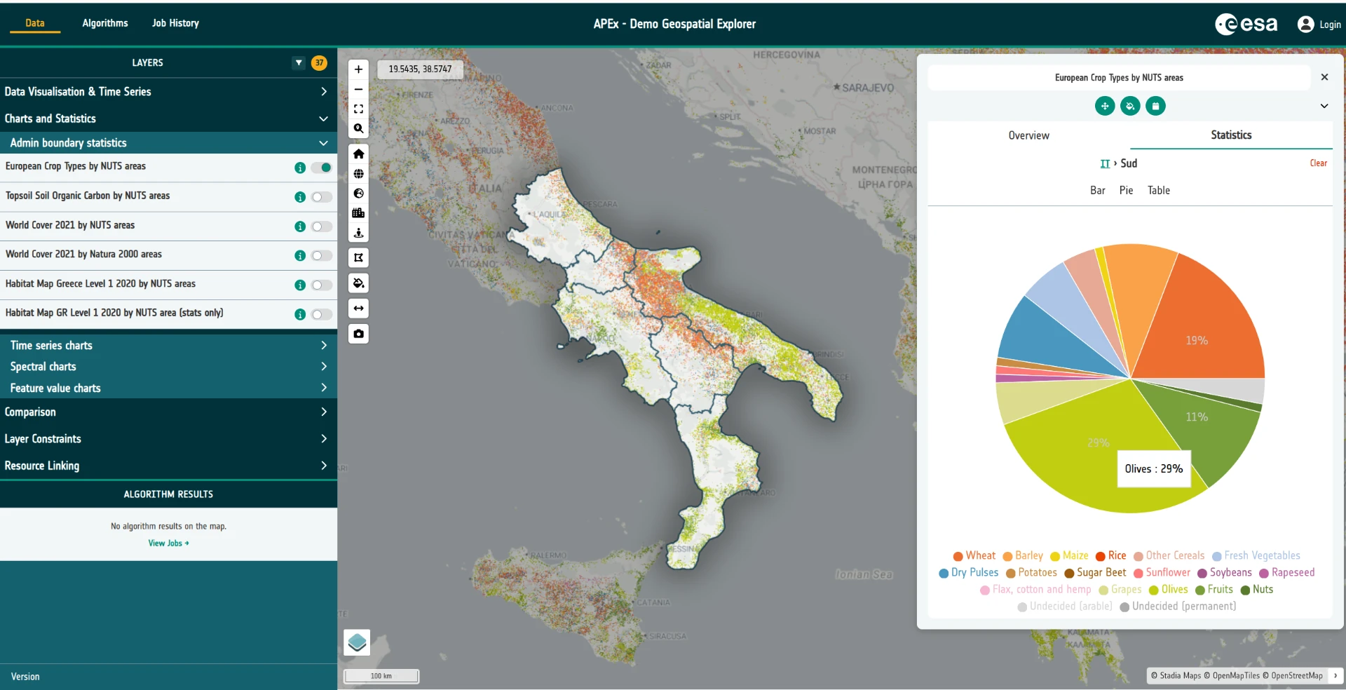
The APEx Geospatial Explorer is an interactive web map dashboard for exploring Earth Observation (EO) data and derived products. It brings together cloud-native geospatial data, SpatioTemporal Asset Catalogs (STAC), on-the-fly algorithm execution and rich visualisation tools — all in a no-code environment that end users can drive from a browser.
Every Explorer deployment is shaped by a configuration — a JSON document that defines the layers, services, styling, charts, filters and storymaps on offer. In later exercises you'll build one of these configurations yourself. For now, the goal is simply to get a feel for what the end-user application looks like and what it can do.
Tasks
1. Open the reference deployment
Open the flagship APEx Geospatial Explorer in a new browser tab:
https://explorer.apex.esa.int/
This particular deployment has been organised around the core areas of functionality the Explorer supports — data visualisation, time series, charts and statistics, constraints and filters, storymaps, and algorithm execution. Treat it as a showcase of what a well-configured Explorer can do.
2. Have a play
Spend some time exploring the application. There is no wrong way to do this — click things, toggle layers on and off, open panels, drag the time slider, try the charts. Some suggestions:
- Switch between different interface groups using the top-level navigation.
- Toggle layers on and off and adjust their opacity.
- Open a layer's data visualisation controls and experiment with colormaps or RGB composites.
- Try any time series layers — scrub the timeline and watch the map update.
- Open a storymap if one is available and step through it.
- Apply a constraint or filter and see how the map responds.
Don't worry about understanding every control yet — you'll meet them again in later exercises.
3. Browse the Solutions Gallery
Head over to the APEx Solutions Gallery to see what other teams have built with the Explorer:
https://apex.esa.int/resources/solutions-gallery
Filter the gallery on "Geospatial Explorer" as a component and take a look at a few of the examples. Each entry links out to a live deployment configured for a specific scientific or operational use case. Pick two or three that look interesting and open them up — it's a great way to see the range of applications a single configurable tool can support.